In recent years, heavy rainfall and the resulting flash floods have increasingly led to extensive damage to technical and social infrastructure. As part of the “WaX - Hydrological extreme events” funding measure, interdisciplinary solutions are being developed as part of twelve joint projects so that cities and municipalities can better prepare for heavy rainfall, floods and droughts. 25 million euros are being invested in innovative monitoring, forecasting and communication concepts, climate-adapted water infrastructures as well as operational and risk management strategies.
The Environmental Campus Birkenfeld is involved in the BMBF joint project FloReST, which is researching innovative technical measures for identifying and mapping emergency drainage routes as well as risk communication measures to minimize future damage to people and infrastructure.
Further information: https://www.umwelt-campus.de/iss/projekte/laufende-projekte/florest-starkregen-hochwasser
official project website: https://www.bmbf-wax.de/en/
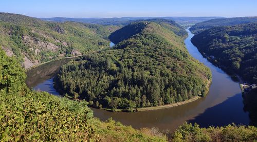
The Saarschleife is a well-known geotope in the SaarLorLux region and beyond, but there is no visual representation of its relief history and genesis. Therefore, the Saarschleife was selected as a pilot project for an analysis of the landscape genesis and for a 4D mapping and landscape representation using mixed reality methods. As part of the project, a space-time visualization of the relief history and geological development of the last 300 million years will be created in selected epochs. For this purpose, today's geological and geomorphological conditions are mapped, overlaid with a recent terrain model and transferred into a digital model of the subsurface. At the end, the “Saarschleife” geotope application will be made available to the public as an infotainment exhibit.
The project runs from January 2022 to December 2024.
Further information: https://www.umwelt-campus.de/forschung/projekte/projekte-entdecken/virtual-geology
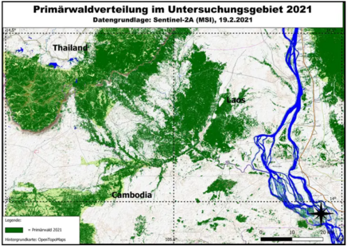
The “EWALD” project aims to record the processes of land use change in Southeast Asia by evaluating multi-temporal earth observation data and to develop proposed solutions for the protection of mountain forest areas and isolated lowland forests. The background to this is the overuse of the earth by humans and the associated loss of biodiversity. The project is a collaboration between the Institute for Software Systems at the Environmental Campus of Trier University of Applied Sciences and the Department of Physical Geography at Saarland University.
Further information: https://www.umwelt-campus.de/iss/projekte/laufende-projekte/ewald
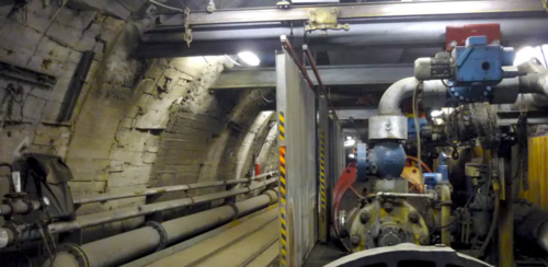
Trade associations report accidents during excavation work near underground pipelines almost every day. The causes of damage to pipeline networks are often insufficient knowledge of the type and location of the pipelines and inadequate plans. The project aims to highlight the importance of knowledge of the historical and recent use of the underground and to develop a cross-media information system for documenting subterranean structures. Such a system should offer the user added value through immediate access to information and thus avoid damage caused by unexpected structures during construction.
Further information: https://www.umwelt-campus.de/forschung/projekte/projekte-entdecken/terra-incognita
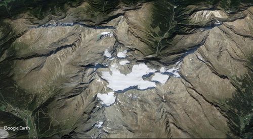
The “Melting Frontiers” project aims to illustrate the effects of climate change in the Alpine region through the visualization of space-time data. By combining geographical information and temporal developments, the changes in this sensitive ecosystem are to be made comprehensible to a wide audience
Further information: https://www.umwelt-campus.de/iss/projekte/laufende-projekte/melting-frontiers
You are leaving the official website of Trier University of Applied Sciences